HOME
GALLERIES
American Infrared 'Scapes
'Scapes, because this page includes landscapes and cityscapes, even seascapes! The unifying theme is panoramic North America in infrared.
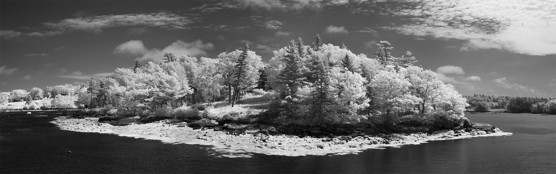
Summer Island, Maine We were supposed to go out to sea and look at puffins, but out to sea was rough that day and the tour company took us in instead, along the Sheepscot River. It was a good deal either way, being a beautiful summer day with wonderful rocky coastal Maine scenery, well arranged for the infrared photographer.
I like to think of this photo and the following two as a tryptich in a large Bauhaus-y modern building...
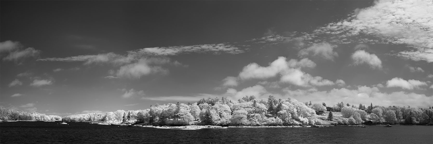
Sheepscott River, Maine
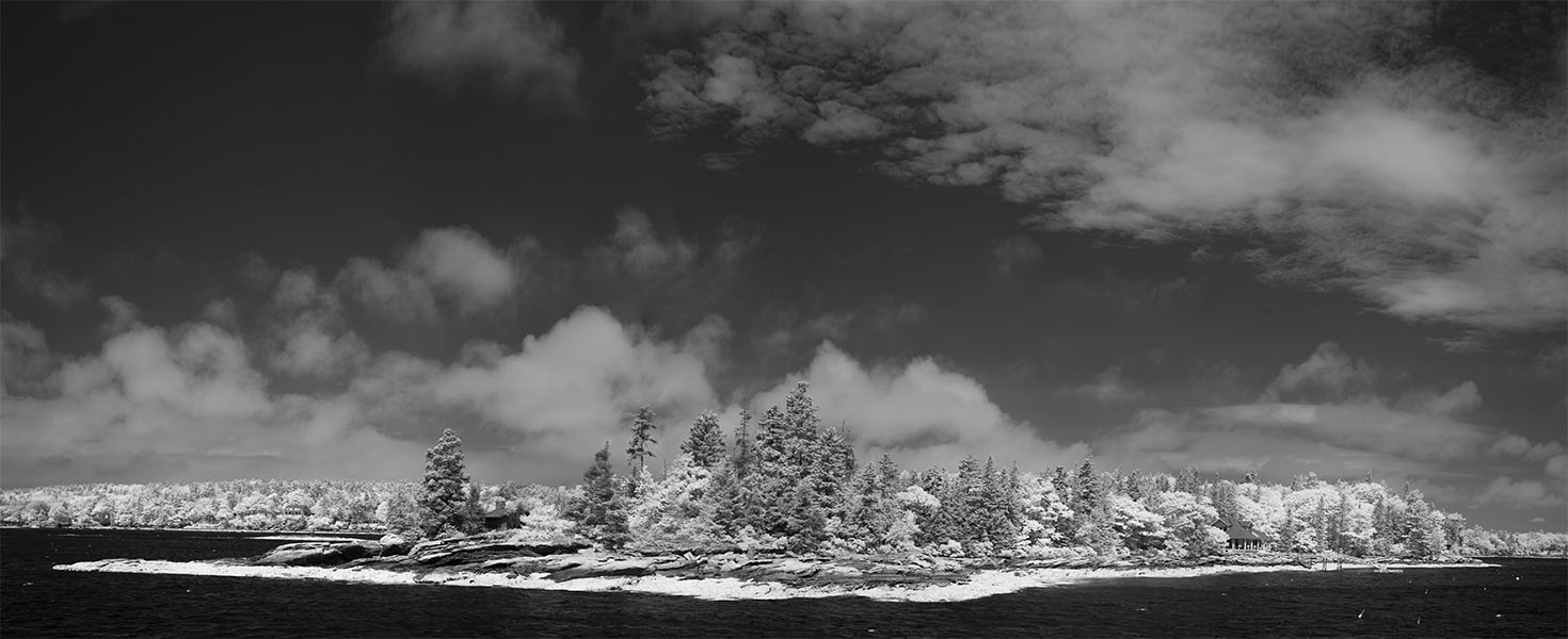
Peninsula, Maine
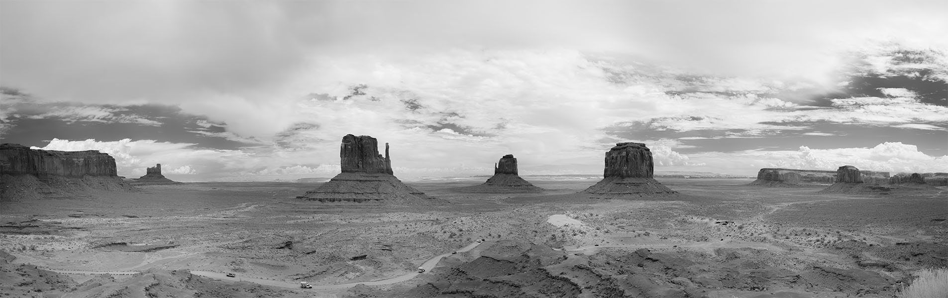
Monument Valley, Navaho Nation Big scenery, like so much of the American West! This is a national park, but the nation isn't the United States, but the Navaho Nation. They graciously share it with the rest of us, fellow Americans and foreigners alike. I shot this from the viewing platform next to The View Hotel. I was surrounded by Americans, French, Italians, Chinese, and a handful of Germans. It's an eight frame stitched panorama, but the scenery still wraps around some distance beyond the edges of the picture to the left and right. You can get a sense of the scale from the road leading in the valley itself with the little cars on it.
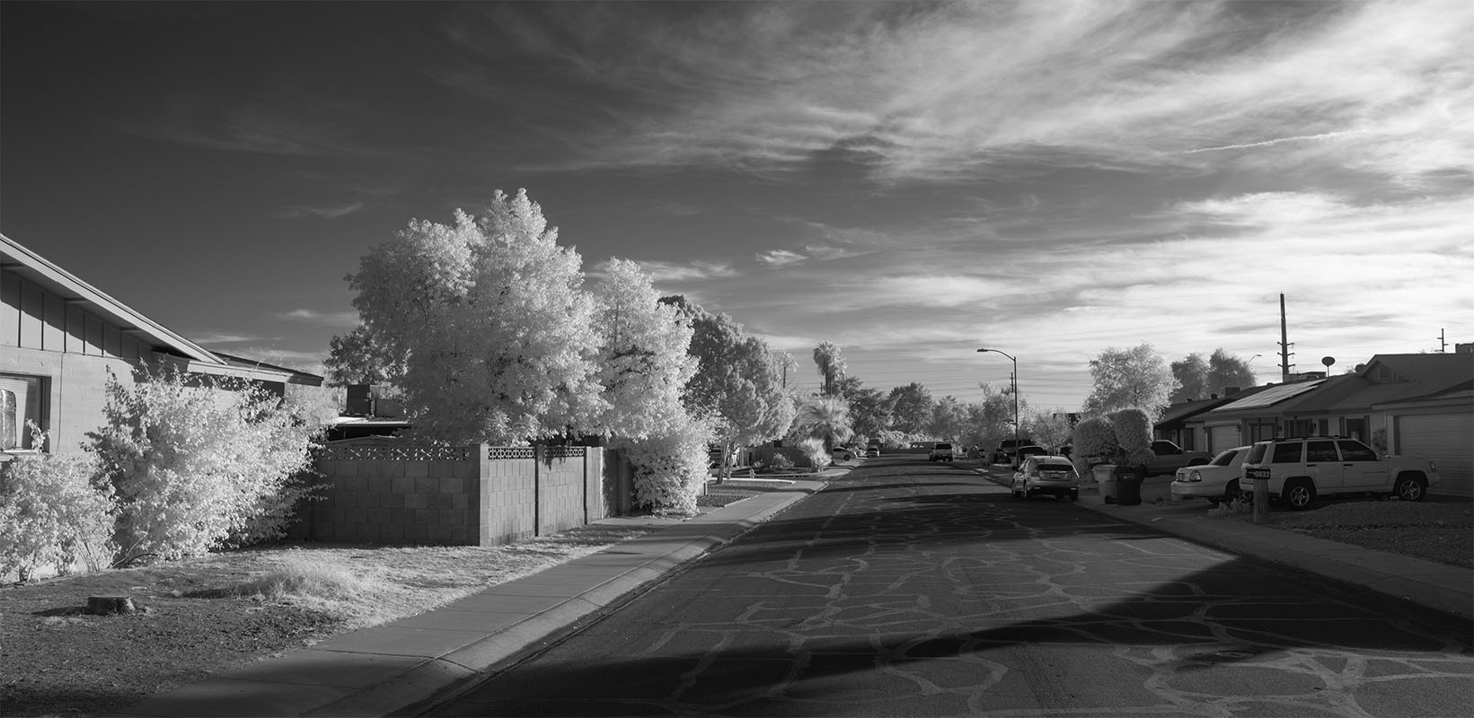 Metroplex Neighborhood, Phoenix Arizona My sister and her family live in Phoenix, so I find myself in Arizona from time to time... Here's a view of her neighborhood in northwest Phoenix proper, late in the afternoon. The American West! Even in the city the sky is big.
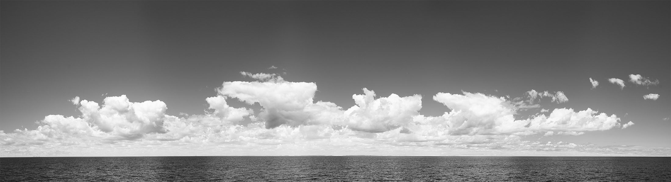
Off Cape Ann A real seascape! Julee took me to look at whales, and the whales weren't having much of it. We did see a few, but not very many, and not very close. I'm sure they had their own business to attend to. But, I did take a lot of pictures, including this stitched panorama, made up of four vertical frames. (The alert will have guessed that the previous pictures are also stitched panoramas.) At full resolution, the land, from Boston on the left to Cape Ann and Thacher Island on the right, is just visible on the horizon, if you look closely. At web resolution, as here, not so much.
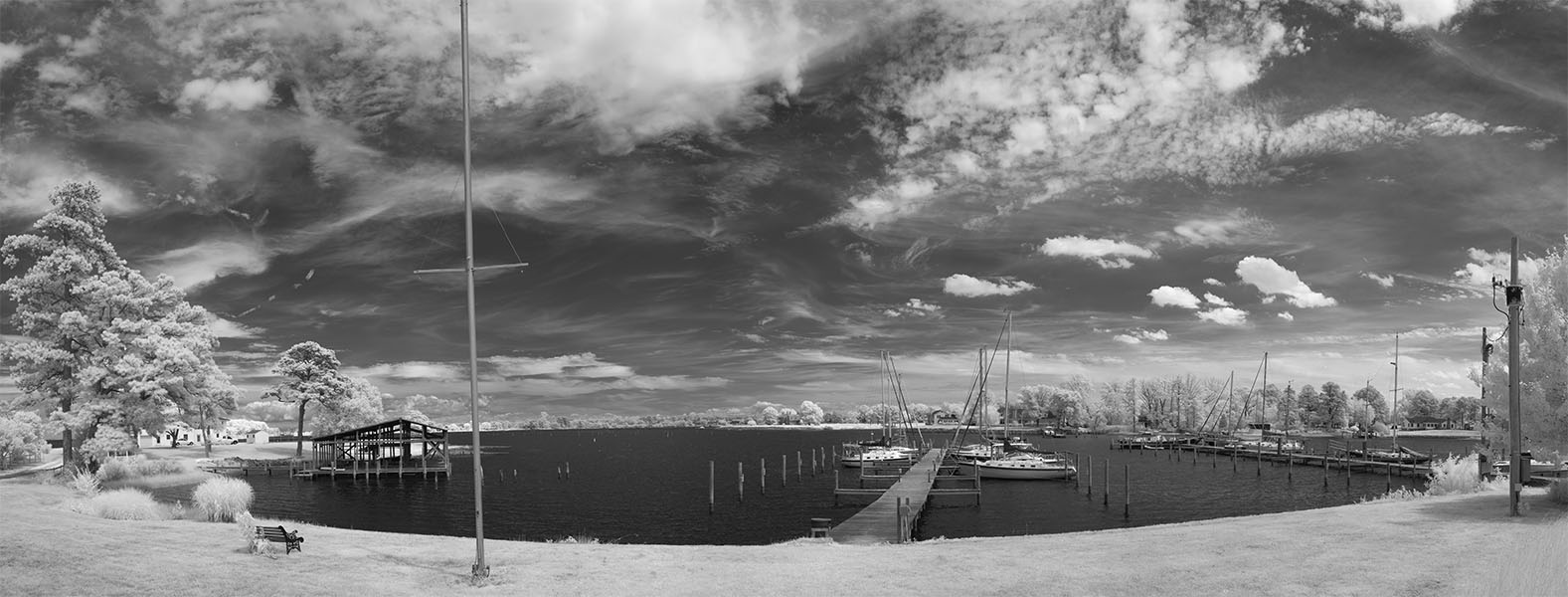 Coan River Marina, Lottsburg, Virginia Another picture of the water from Coan River and Coan River Marina on the south shore of the Potomac close to where it meets Chesapeake Bay. It's lovely remote rural near-South, or at least it FEELS remote. But the water is integral to the land here, and the water feels like a gateway. The Potomac leads to the whole world, one way upstream to the center of power that is Washington DC, and the other downstream to the Bay, with Philadelphia to the north, and the whole wide world to the south through the bay and out into the Atlantic. Knowing the broad water beyond the Coan River mouth was economically critical and remains important gives a little extra flavor to the scene! This panorama was assembled from seven individual frames.
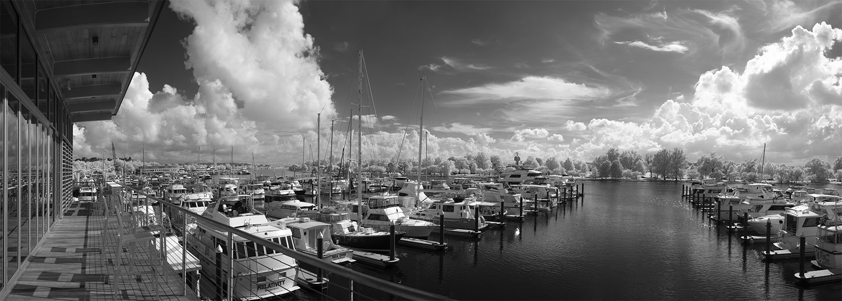
The Capital Yacht Club at The Wharf This is home in Washington DC... Two decades ago I was newly and fundamentally unattached and let my small and surprisingly affordable Connecticutt Avenue apartment go and moved onto a houseboat along this Waterfront. A bit over a year later I joined the Capital Yacht Club, and moved the houseboat itself a couple of hundred yards north to the club's part of the Channel. I've lived there whenever I had a Washington tour, on four different boats. At the beginning it was a quiet corner of Washington that felt a little forgotten. Since then a second redevelopment (the first happened in the '60s and '70s) has washed over the neighborhood like a tsunami. Really, it's unrecognizable. It's now a dense, happening, and rather expensive neighborhood of high rise buildings. My Club held on, with great effort, and you see its new look in the picure above. Everything is brand new, the clubhouse, the docks, everything!
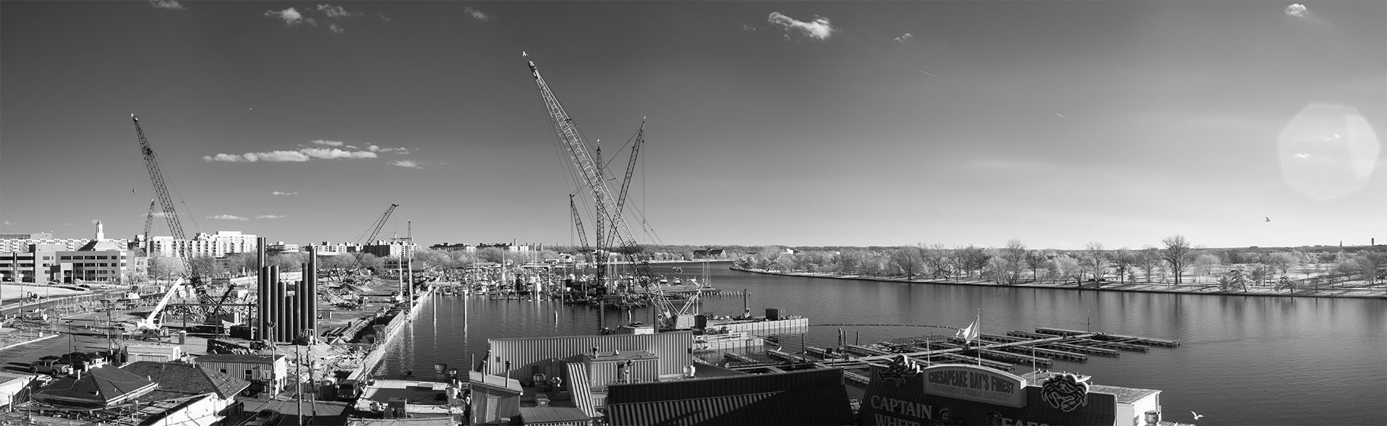
Construction, Washington Waterfront, January 2015. This is what it looked like when it was all under construction. Three years from a hole in the ground to a complete new neighborhood. (Of course it took them a couple of years to make the hole in the ground so they could start!) I'd very much like to have the comparable "now" picture, but when I was recently in Washington it rained. No decent photography (at least in my style) possible. A four frame stitched panorama, taken from the south side of the Fourteenth Street Bridge.
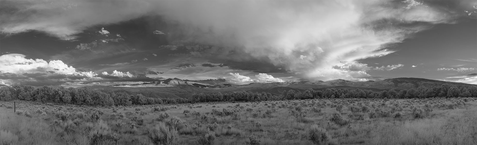
Mount Sopris, Colorado This is just outside of Glenwood Springs, Colorado, where my sister lived at the time, looking south and across the valley toward Aspen and Mount Sopris itself.
GALLERIES